M 053 / 18302 Masks & Controlschematic / technique preview

Point Cloud Proxy

segmentation, masks & control
Typeface · DotGothic16

Schematic or classical approach — not a trained AI model output.
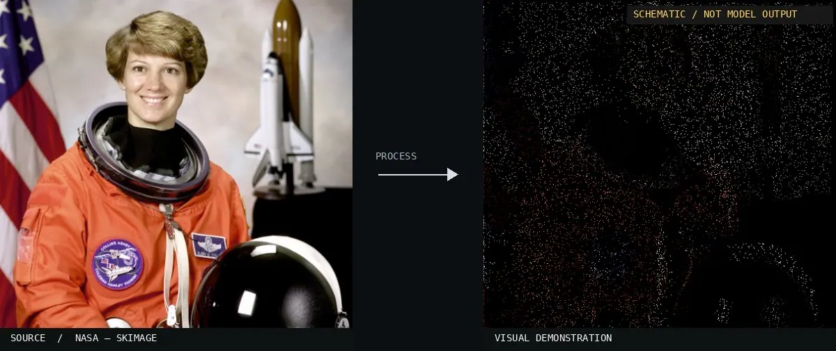
Schematic or classical approach — not a trained AI model output.Image: NASA / Eileen Collins · scikit-image (public domain)View source ↗

Prompt

Transform this image into a Point Cloud Proxy, reconstructing visible forms as dense, discrete dots sampled from the photograph's colors against a dark background. Suggest shallow spatial depth through dot size and brightness, leaving small gaps between points and avoiding continuous surfaces or connecting lines. Keep the original subject and composition.

Identify

Closely placed dots translate the photo into spatial fragments.

Principle

A point field consisting of image coordinates1 and schematic depth2 is projected.

Try it out

Reduce the score.

Classification

Schematic visualization, not neural inference.

Further examples · 7 images

Ouster OS1-64 lidar point cloud of intersection of Folsom and Dore St, San Francisco
02 Ouster OS1-64 lidar point cloud of intersection of Folsom and Dore St, San FranciscoA San Francisco street corner rendered as a sparse point cloud. Individual dots define urban geometry through spatial coordinates, creating the characteristic transparent and fragmented appearance of a raw LIDAR scan.Daniel L. Lu · CC BY 4.0 · Wikimedia Commons
BNF Lidar HD
03 BNF Lidar HDA three-dimensional visualization of buildings using a gradient-mapped point field. The discrete nature of the data points is clearly visible on the ground plane and building facades.FuzzyGeo · CC BY 4.0 · Wikimedia Commons
Intel Realsense depth camera D435
04 Intel Realsense depth camera D435This depth camera uses infrared sensors to calculate 3D spatial fragments. It is a direct apparatus for generating real-time point cloud proxies from physical environments.Marc Auledas · CC BY-SA 4.0 · Wikimedia Commons
Man using a 3D scanner in a technology exhibition setting
05 Man using a 3D scanner in a technology exhibition settingA handheld 3D scanner generates a digital model on a monitor. The screen displays a schematic point field and mesh, illustrating the process of translating a physical object into spatial fragments via coordinates.Shixart1985 · CC BY 2.0 · Wikimedia Commons
Point cloud data of the David W. Dyer Federal Building and United States Courthouse in Florida
06 Point cloud data of the David W. Dyer Federal Building and United States Courthouse in FloridaA dense field of discrete points represents the facade of a building. It translates architectural photography into spatial fragments defined by image coordinates and depth.Unknown authorUnknown author · CC BY-SA 4.0 · Wikimedia Commons
Использование 3D-сканера SHINING 3D FreeScan Combo
07 Использование 3D-сканера SHINING 3D FreeScan ComboA screen displays the resulting digital proxy of a physical object. The process demonstrates how structured light translates a physical part into a schematic digital coordinate field.Surface engineering · CC BY-SA 4.0 · Wikimedia Commons